0%

Mariwa-Sardine Hill

Oko Gold Region

Strategic Land Position in Guyana’s Emerging Oko Gold District

Overview

  • 100% acquisition via property option purchase
    • US$250k cash
    • 35M common shares
    • US$200k cash annually for 4 years (US$800k total)
    • 1.0% NSR with US$4M 100% buy-back right
  • Three contiguous MPMS permits totaling approximately 3,240 acres
  • Located within the prolific Guiana Shield gold province
  • Situated within the rapidly emerging Oko-Cuyuni gold district
  • Historical exploration completed by International Roraima Gold Corp., Newmont, and Guyana Frontier Mining
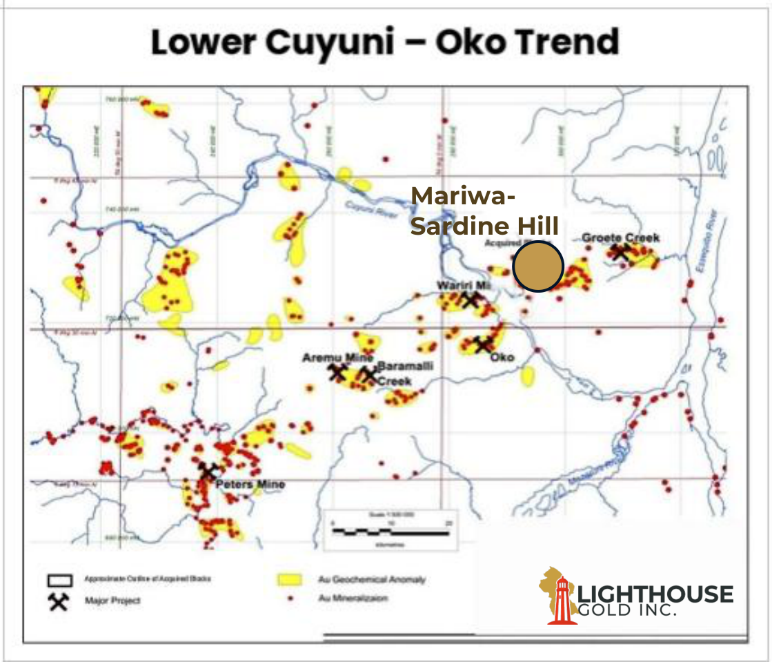
31kmfrom Oko Gold Project
8kmfrom Wariri Gold Project
18kmfrom Groete Creek Project
Lower Cuyuni – Oko Trend gold anomaly map with Mariwa-Sardine Hill location
Regional Setting

Located Along a Major Emerging Gold Corridor

Exposure to a rapidly consolidating mining district.
Regional Context

  • Located within the Oko-Cuyuni mineralized corridor
  • Over 100 years of historical gold production from artisanal mining
  • Hosted within the same geological terrain as several significant gold discoveries
  • Recent consolidation activity has highlighted the strategic value of district-scale land packages
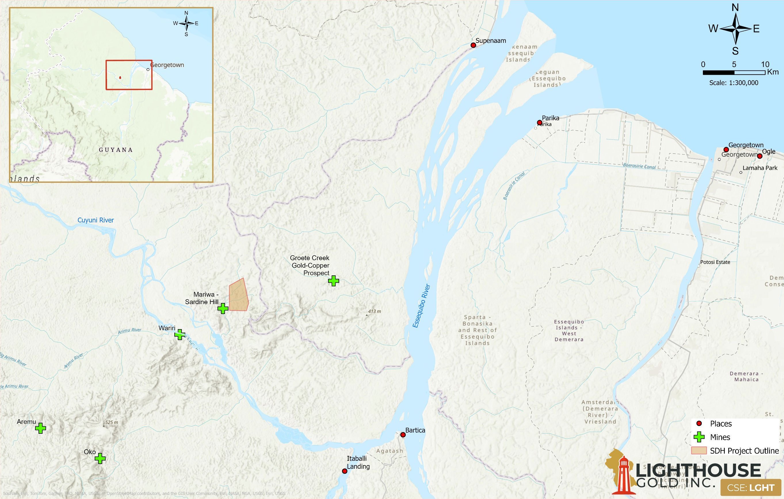
Regional location map — Mariwa-Sardine Hill within the Lower Cuyuni district, Guyana
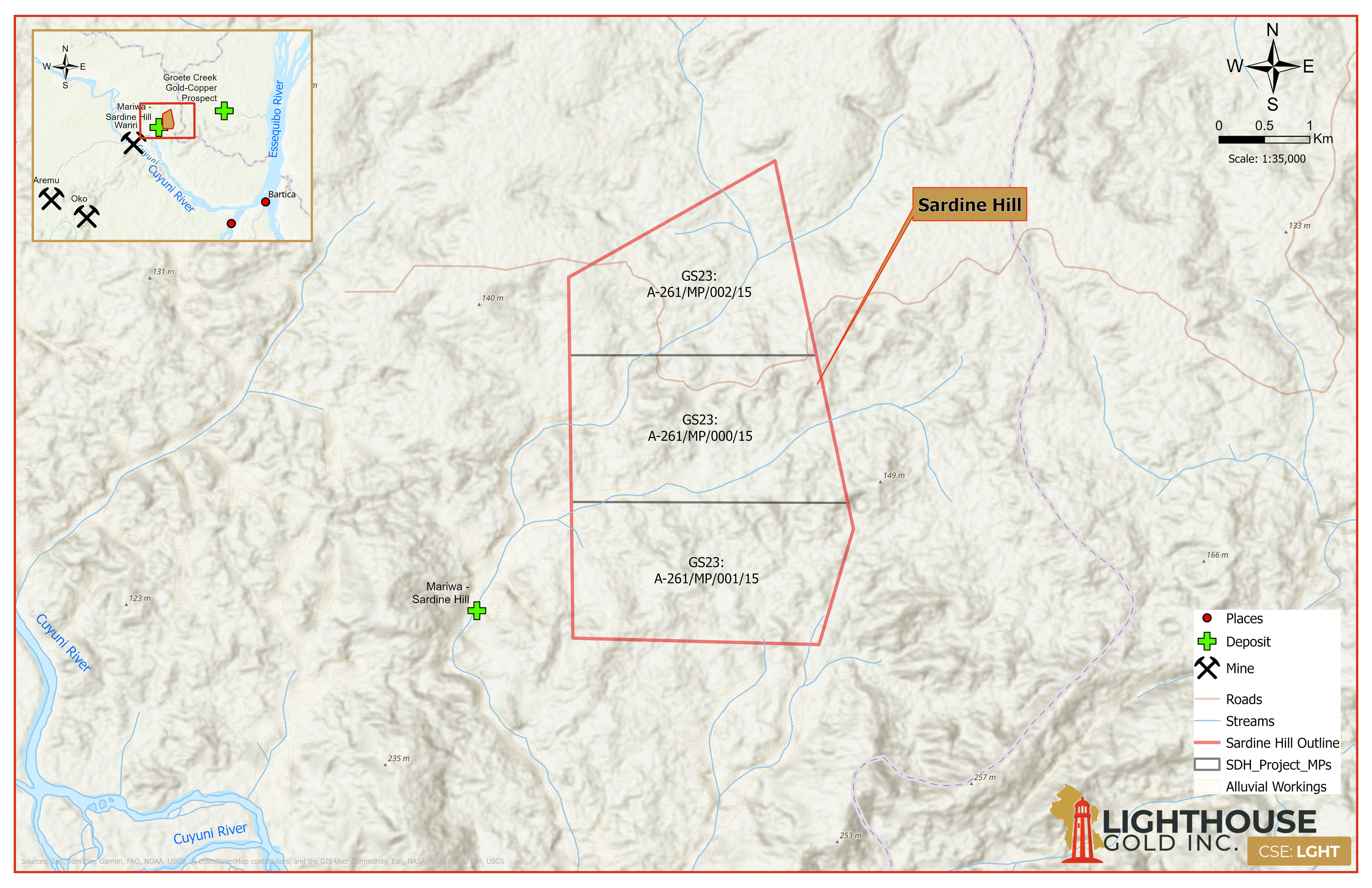
Sardine Hill property map showing the three permit boundaries, surrounding waterways, regional inset, scale and legend
Sardine Hill Property Map — select to enlarge.
Dormant gold project with vast economic upside

Historical Exploration Demonstrates Large Gold System Potential

Advanced Exploration

  • Highlight drill hole: 113.5 m @ 1.39 g/t Au*
  • Mineralization remains open along strike and at depth
  • Hole terminated in saprolite
  • Auger values up to 2.99 g/t Au

High-Grade Zone

  • Trench result 17.40 g/t Au over 1 m*
  • Multiple EM conductors remain untested by drilling

Underexplored Target

  • Auger results up to 1.95 g/t Au
  • Main anomaly remains open
  • Strong regional geochemical support
  • Geological, geophysical and geochemical data outline targets in saprolite and hard rock that haven’t been tested
The District

Historical Exploration Highlights Across Three Blocks*

Block 1

  • The most advanced block in terms of historic data
  • Diamond drilling confirmed gold mineralization (1.39 g/t over 113.5 m ending in saprolite)
  • Deep weathering which in places extends greater than 100 m vertically, according to historic literature
  • Mineralized body remains open along strike and at depth
  • Several auger drill results showed gold up to 2.99 g/t Au from shallow depths

Block 2

  • Least explored block
  • Power auger sampling returned values including 1.95 g/t Au
  • Main anomaly remains open to the west
  • Regional stream sediment sampling returned 0.033 g/t Au (BLEG) in the Mariwa River drainage

Block 3

  • Hosts the highest individual gold result in the dataset
  • Trenching returned 17.4 g/t Au over 1 m within mica-chlorite schist
  • Interpreted high-grade structural zone linking the northern and southern anomalies
  • Multiple electromagnetic conductors across the block have yet to be drill tested

*Historical results have not been independently verified by Lighthouse Gold. References to drilling intersections refer to historical data acquired by third parties. Lighthouse Gold is currently preparing an independent NI 43-101 compliant Technical Report to verify & summarize all historical work over the Mariwa/Sardine Hill project.

Strategy

Clear Path to Define Gold Mineralization

Phase 1

Data Consolidation

  • Digitize historical datasets
  • Compile drilling records
  • Reconstruct historic drill hole and geophysical databases
  • Build integrated GIS platform
  • Actively pursue additional strategic land acquisitions to build district-scale portfolio
Phase 2

Target Generation

  • Structural interpretation
  • Geophysical reinterpretation
  • Geochemical targeting
  • District-scale prospect ranking
  • Airborne drone magnetics
  • Evaluation of regional exploration targets
  • Prioritize targets
Phase 3

Field Validation

  • Mapping
  • Sampling
  • Trenching
  • Ground IP geophysics
  • Shallow auger drilling
Phase 4

Drill Testing

  • Priority targets
  • Known mineralized zones
  • Untested conductors
  • Fresh rock source targets
Mineralization Definition via Drill & Exploration Programs
Roadmap

Work Program Timeline — Mariwa-Sardine Hill

Work Program*Q4 2026Q1 2027Q2 2027Q3 2027
Close Mariwa-Sardine Hill Acquisition
Phase 1 — Data Consolidation
(Includes NI 43-101 Property of Merit Report)
Phase 2 — Target Generation
Phase 3 — Field Validation
Phase 4 — Drill Testing (~3,500 m)

*Indicative only — sequencing and timing are subject to results and financing.

Join Our Mailing List

Sign up to receive updates on our latest news and events. Your email will never be shared or sold and you can opt out at any time.

No, I don't want to receive updates

You're almost there!

Please check your inbox to confirm your subscription.

Close